Trenutno je dostupan izbor od dva izvora karata. To može biti „OSM” ( zadana opcija ) karta svijeta ili Google karta svijeta. Prebacivanje između njih je jednostavno, jednostavno kliknite na složene karte u donjem desnom dijelu karte. Trenutno prikazana karta bit će prikazana na vrhu. Korisnik može birati između četiri vrste karata:
- OSM – Otvori kartu ulica;
- Satelit – Prikazuje Google satelitsku kartu bez označavanja ulica;
- Hibrid – Prikazuje Google satelitsku kartu s dodatnim oznakama ulica s mapiranja ulica;
- Ulica – Prikažite Google mape ulica bez satelitskog snimanja.
| Icon | Description |
|---|---|
| Buttons to "zoom in" or "zoom out" of the map. | |
| Google „Street View“. (Works on all maps, except OSM). To use Google Street View, click and hold this icon and then frag the icon to the street you want to observe. To exit Google Street View, the user must click the grey arrow located at the top right side of the screen. | |
| Traffic information. To activate this function, simply click the icon (This function works only on the Hybrid or the Street map). This function display traffic intensity (in places where this information is available) by displaying colored lines on the map. Green and similar colors indicate low traffic intensity, while Red and darker colors indicate high traffic intensity. | |
| Routing & Tasks. Clicking this icon will open the routing & tasks menu on the left side of the screen. Routing & Tasks menu is described in a separate section. | |
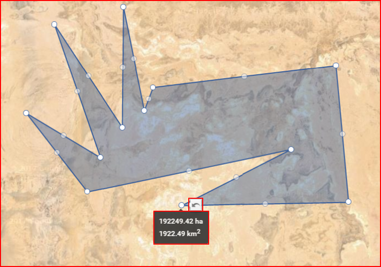
| Measure area. Clicking this icon activates the measuring tool. While it is activated, the user can mark a territory on the map (similar to how geozones are marked), by connecting several dots. Once the dots are connected, the covered territory is highlighted and additional perimeter dots appear. The user can move these dots (click & drag) to change the measuring area (After moving a dot, a "Undo" button appears, clicking which allows to return the dot to the previous position). Moving the mouse over the highlighted area will display its size. An example is shown below. | |
| Geozones. Clicking this icon will expand the right side of the screen, where a list of all existing geozones for the current user is located. An example with a description is provided further below. |
Kao što je spomenuto u prethodnoj tablici, klikom na gumb „Geozone” otvorit će se bočni prozor kao što je prikazano dolje.
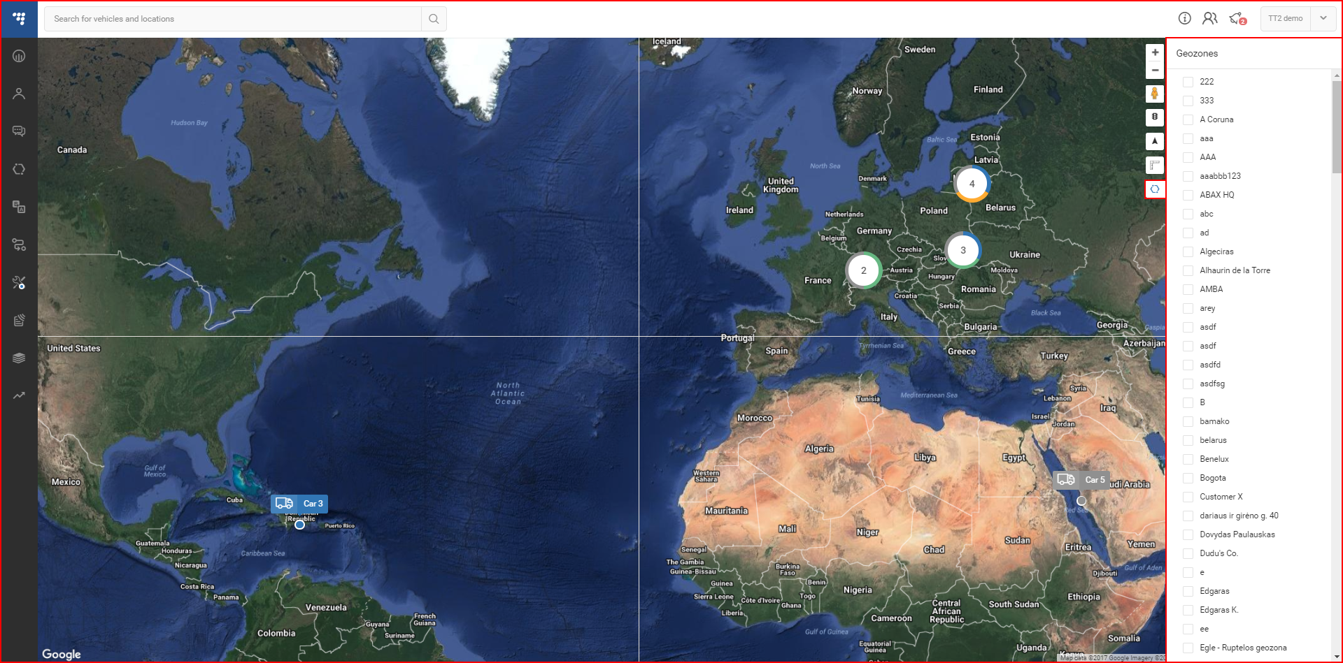
Ovdje korisnik može odabrati hoće li prikazati ili sakriti bilo koju od dostupnih geozona na karti. Nakon odabira, geozone će se sada prikazivati na karti, bez obzira je li ploča geozona otvorena ili ne. Geozone su označene plavim oznakama, geozone u obliku balona su POI, dok su šesterokuti poligonalne geozone.
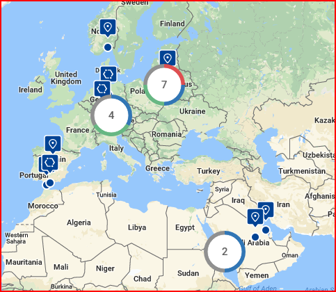
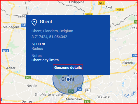
Kada korisnik odabire geozonu s bočne ploče, karta će se automatski zumirati kako bi se sve odabrane geozone uklopile na zaslon. Klikom na oznaku geozone prikazat će se informativni informativni okvir o geozoni. Informativni okvir sadrži sljedeće informacije:
- Ime;
- Mjesto;
- Koordinate – mogu se kopirati klikom na njih;
- Radijus ili površina;
- Napomene (ako su dodane).
Klikom na „Detalji geozone” otvorit će se ploča Geozone s detaljnim informacijama o geozoni.
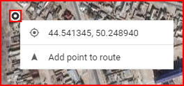
Desnim klikom na bilo koju točku na karti otvorit će se skočni prozor s točnim koordinatama te točke. Korisnik može kopirati koordinate klikom na njih ili ih dodati ruti klikom na „Dodaj točku ruti”.