V súčasnosti sú k dispozícii dva zdroje máp. Mapa sveta “OSM” alebo Google. Prepínanie medzi nimi je ľahké, klikne sa na symbol zväzku máp v spodnej časti mapy vpravo. Aktuálne zobrazená mapa je zobrazená hore. Možno si vybrať zo štyroch typov máp:
- OSM – Open street maps;
- Satellite – Zobrazuje satelitnú mapu Google bez označenia ulíc;
- Hybrid – Zobrazuje satelitnú mapu Google s označením ulíc;
- Street – Zobrazuje mapu ulíc Google bez satelitného pohľadu.
| Icon | Description |
|---|---|
| Buttons to "zoom in" or "zoom out" of the map. | |
| Google „Street View“. (Works on all maps, except OSM). To use Google Street View, click and hold this icon and then frag the icon to the street you want to observe. To exit Google Street View, the user must click the grey arrow located at the top right side of the screen. | |
| Traffic information. To activate this function, simply click the icon (This function works only on the Hybrid or the Street map). This function display traffic intensity (in places where this information is available) by displaying colored lines on the map. Green and similar colors indicate low traffic intensity, while Red and darker colors indicate high traffic intensity. | |
| Routing & Tasks. Clicking this icon will open the routing & tasks menu on the left side of the screen. Routing & Tasks menu is described in a separate section. | |
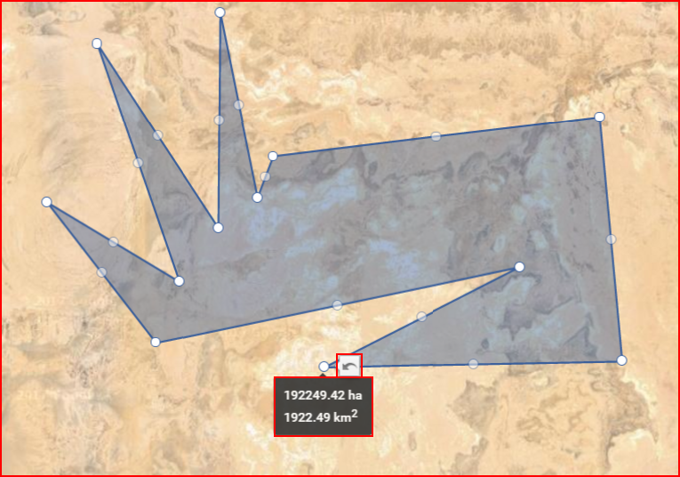
| Measure area. Clicking this icon activates the measuring tool. While it is activated, the user can mark a territory on the map (similar to how geozones are marked), by connecting several dots. Once the dots are connected, the covered territory is highlighted and additional perimeter dots appear. The user can move these dots (click & drag) to change the measuring area (After moving a dot, a "Undo" button appears, clicking which allows to return the dot to the previous position). Moving the mouse over the highlighted area will display its size. An example is shown below. | |
| Geozones. Clicking this icon will expand the right side of the screen, where a list of all existing geozones for the current user is located. An example with a description is provided further below. |
Ako spomenuté v predchádzajúcej tabuľke, kliknutie na tlačidlo “Oblasti” sa otvorí postranné okno, ako uvádza ďalej.
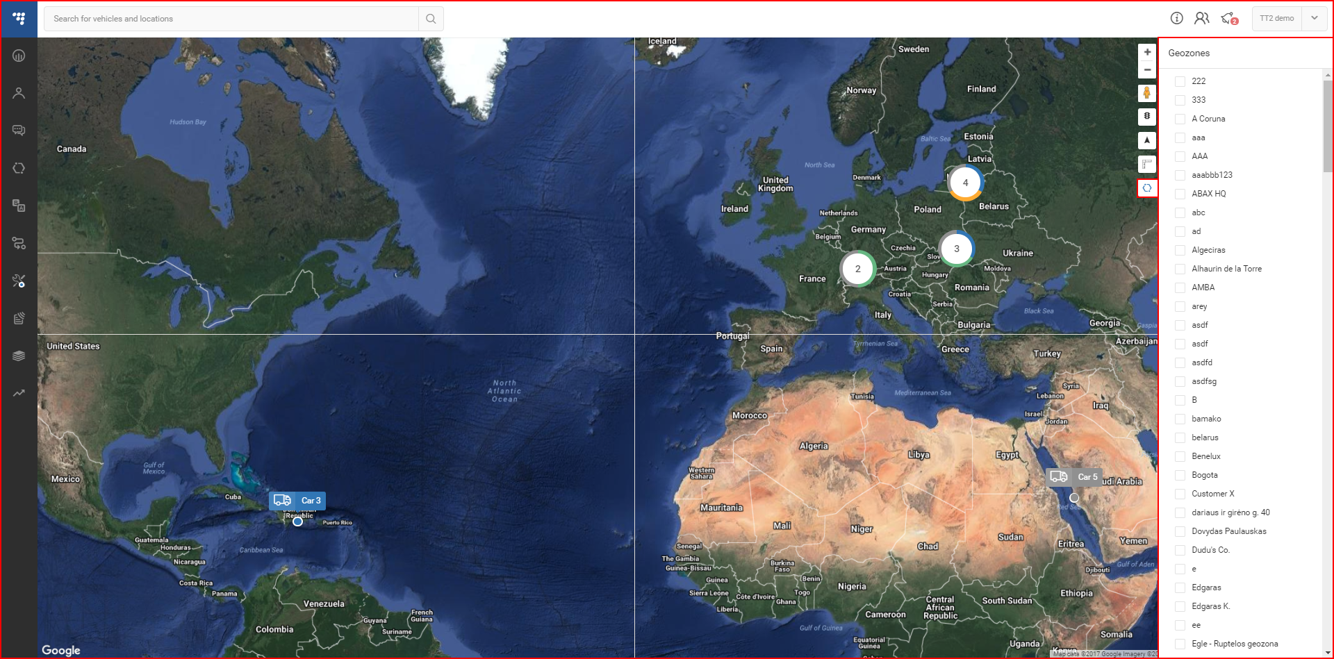
Tu je možné zvoliť, či zobraziť alebo skryť užívateľské oblasti na mape. Výberom oblasti mapa vybranú oblasť nezväčší.